|
Solving the
Palouse Problem.
The Problem: 5,000
generations to build and 4 generations to alter the land and tear it
apart.
Leave it alone,
touch it and feel it, the rule of the minimums will be applied and
we will all be better for it.
____________________________________
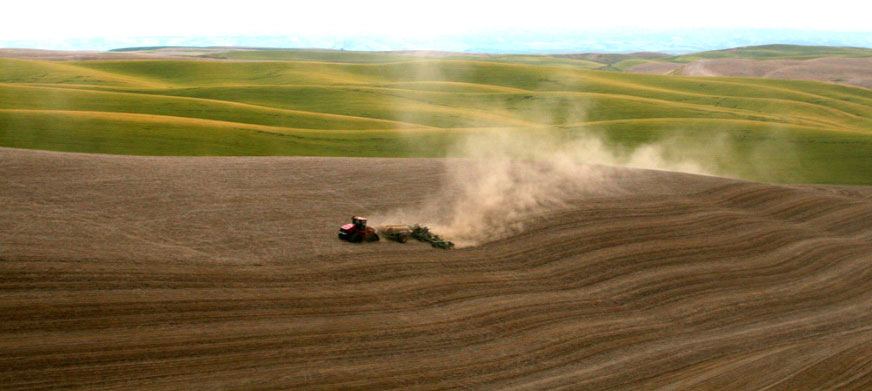
Looking South to
Southwest towards Steptoe Butte and directly over the Idaho state
line and close to Farmington/Tekoa, WA.
North to
South section lines are shown primarily from top to bottom of the
picture.
North to South
Fence lines are created with 125-year tillage effects typically
allowing snow to stack up to 3-foot depths on the fence row.
Steptoe Butte is
shown, The Palouse River Canyon, Kamiak Butte is shown�.and on the
Horizon, is the barely visible Snake River Canyon and the Blue
Mountains of Walla Walla.
Snow fall
patterns create deep drifts on North to Northeast facing slopes. The
slopes face the Northeast and away from the sun creating long
shadows and a micro environment.
This windblown
design is totally opposite of the glacially formed loess Sand Hills
of Nebraska where the north slopes are long and south slopes are
steep.
Aligning up on
the North South line with Steptoe Butte in the picture you can get a
good visual review of man�s effect on the rolling plain.
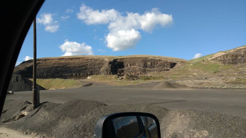
Prescott, Washington, Deep deposits of volcanic ash formed hillside
elevations of 500 feet.
Top to
bottom 500 feet of windblown loess and Cascade volcanic ash.
The Rocky Mountains acting as flow vortices formulating a
non-uniform drop out of volcanic ash.
A transition of time of over 100,000 years or 5,000 generations.
In some locations
the Palouse is severely altered by 3 to 4 generations.
It has not been farmed long and most likely will come to an economic
end in two to four more generations with present practices.
Intensely farmed
since 1955 with the development of Anhydrous Ammonia, the land has
suffered.
The land was rapidly destroyed over a 25-year period following the
development of NH3.
Today the farms have dropped pH levels from the
original 7.2 to 4.5,
An acidic wheat
land soil with not major attempt to correct back to the original pH.
In some locations
the Palouse top soil and landscape is severely altered by 3 to 4
generations.
Theory.
Considering the volcanoes delivery of volcanic ash over the last ice
age, 100,000 years (Mt Mazama eruption 5,677 BC).
The last ice age
was at a�maximum glacial
extent 20,000 years ago, the Cordilleran Ice Sheet
terminated at Spokane Washington and began to recede about 10,000
years ago.
The Palouse landscape evolved with the help of snow and wind, and
hundreds if not thousands of volcanic eruptions.
Grasslands developed slowly at first and the cold season brome
grasses acting as snow traps developing caches of ash. Thus, forming
hills from blowing ash trapped by grass and snow.
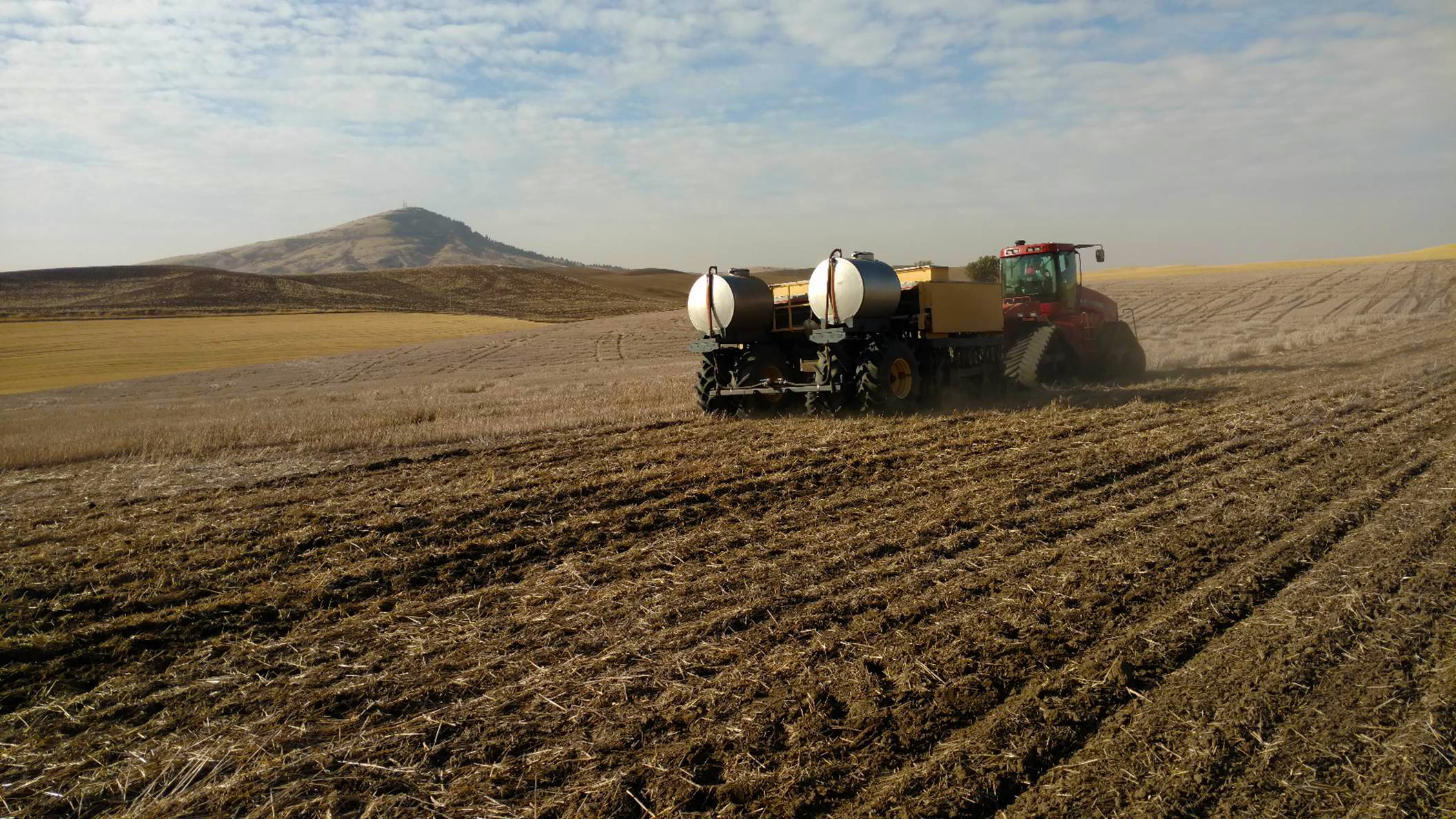
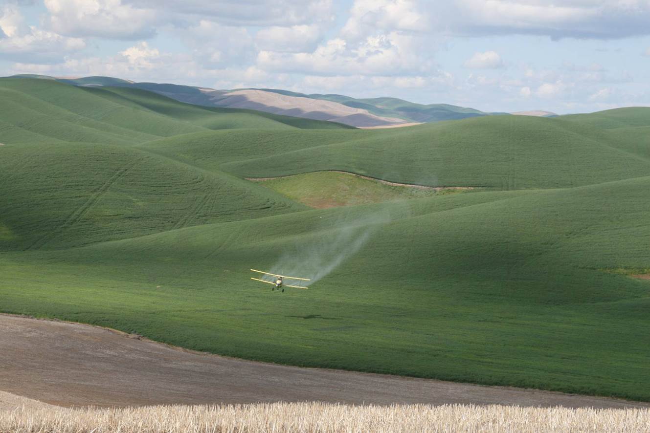
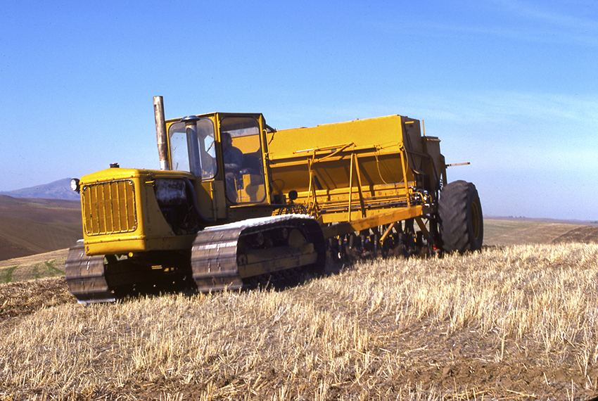
No-tillage is
the only answer. Exactrix Deere 1890 Banding TAPPS and TAPPKTS at
high speed on steep Palouse Slopes.
Pockets of ash
are often found in the Palouse soil profiles.
The deep ash pockets
developed with no establishment of a grass roots to hold it.
The bunch and
blue stem grass introduced carbon and propagated soil life. Soil was
created over 100,000 years.
North facing
slopes store more moisture and developed more grass for grazing wild
life. The north facing slopes are thus higher quality soils across
all elevations.
No Buffalo herds
were involved in the development of these grasslands.
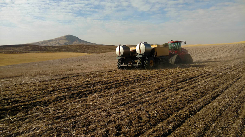
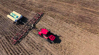
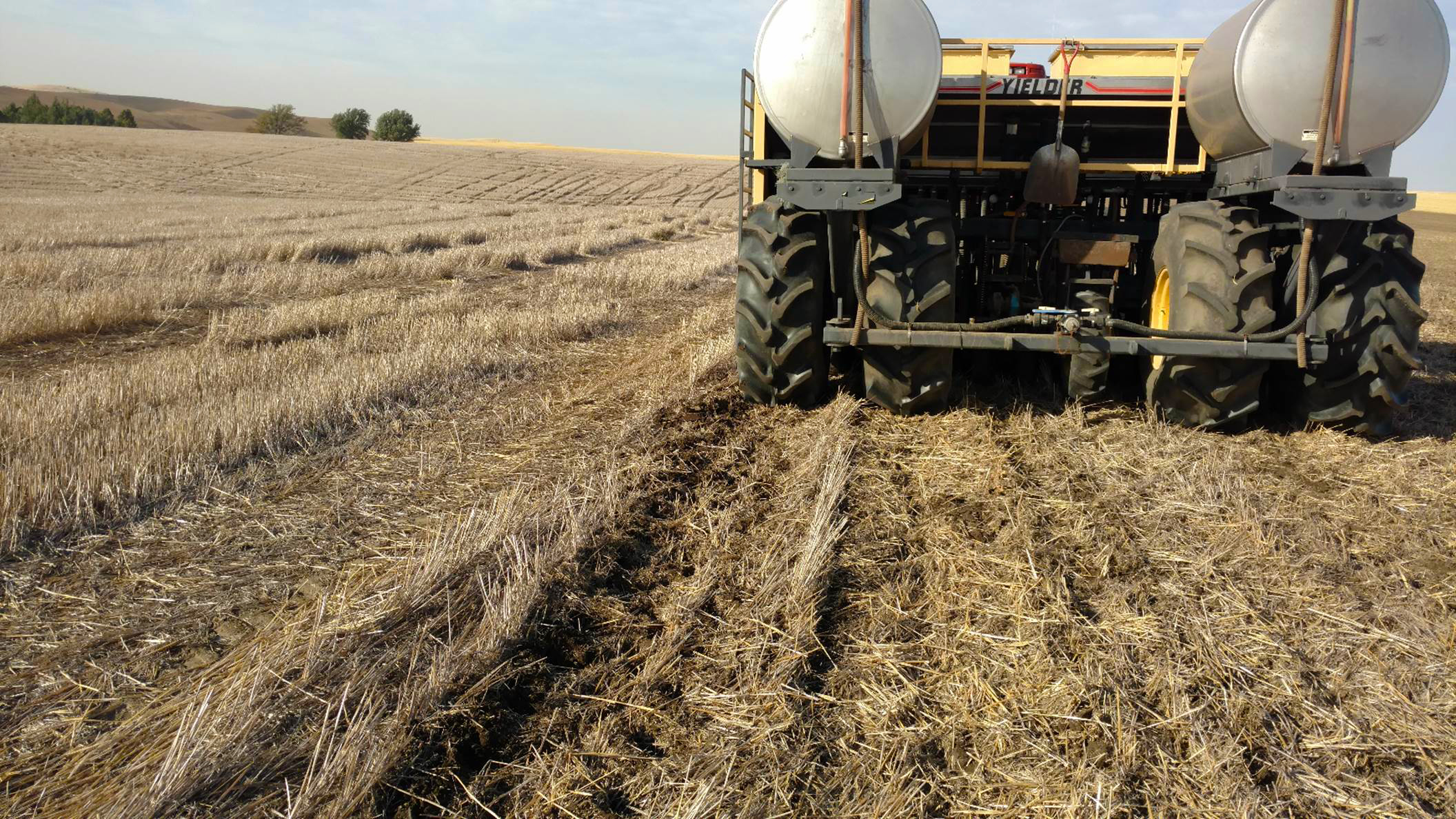
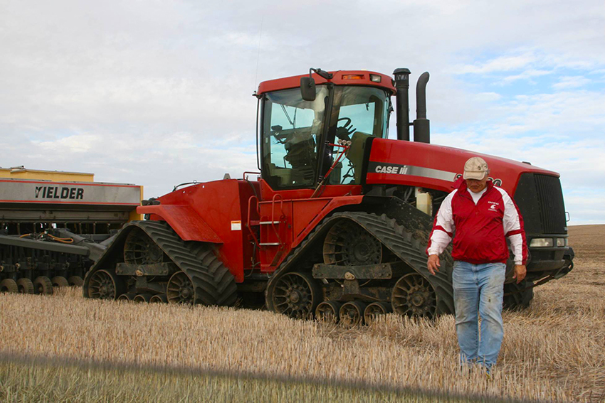
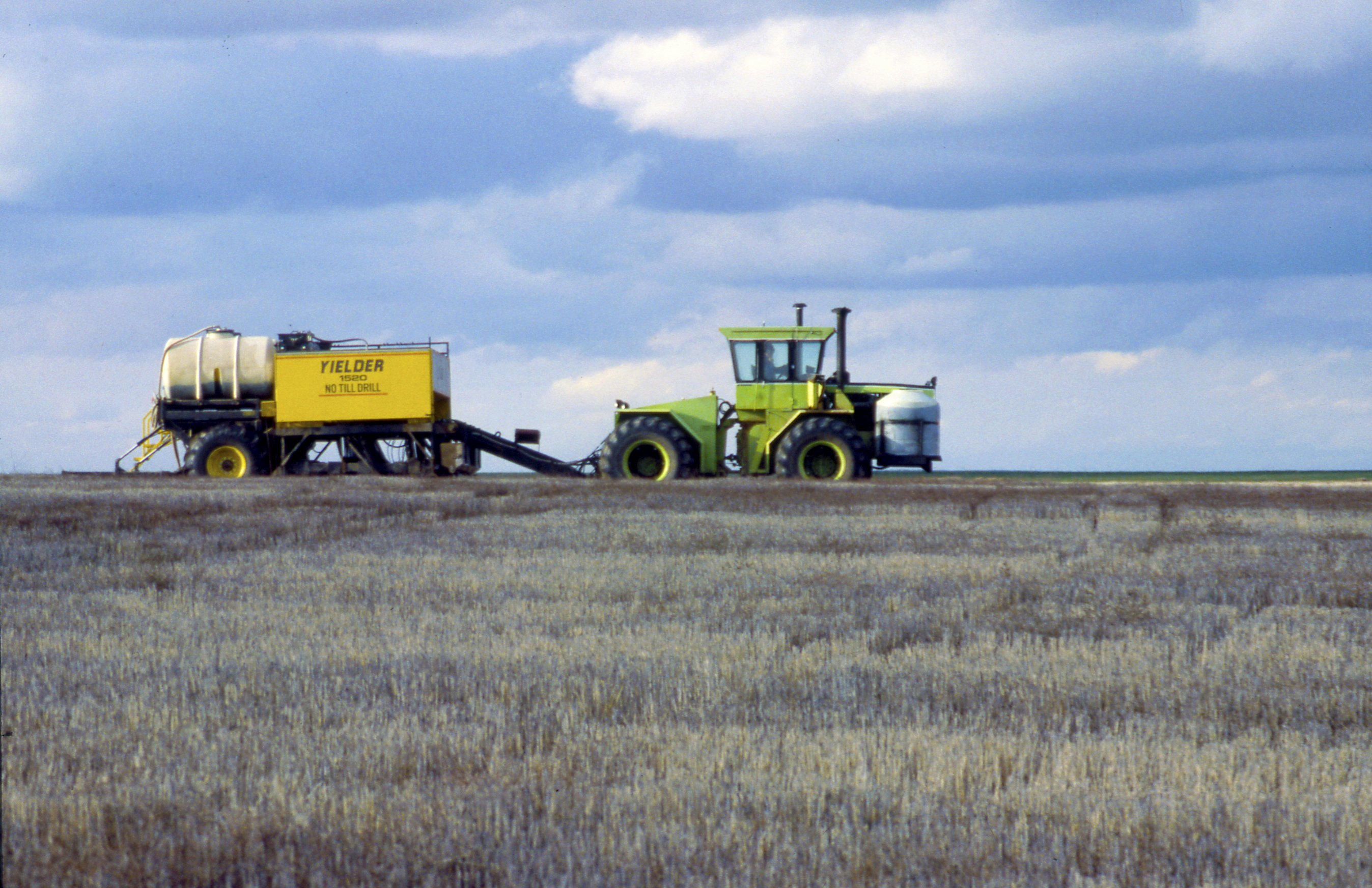
A Yielder
Drill seeds winter wheat in sight of Steptoe Butte, on October 7, 17
a fall scene at Garfield/Col., WA. Roger Pennell 35 years of
continuous No-tillage.
In fact, most
native trees that remain from the 2,500 to 3,000 elevations are
growing on north slopes with the same 2,500 to 3,000-foot south
slopes producing crops or grass for grazing.
Kamiak, Steptoe,
Ladow, McKenzie, Ringo and the Buttes of Farmington, are good
examples of micro climates of the buttes.
The front range
buttes, like Steptoe are the first ranges of the Rocky Mountains and
are 400 million years of age and non
volcanic.
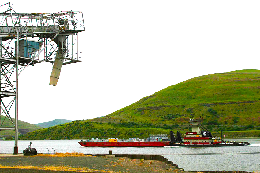
The Palouse River accepts high
nutrient runoff
(Phosphate) at 200 times above the national maximum in flood
stage in an era before No-tillage. A big change has come to the land
since 1974 and beginnings of No-tillage.
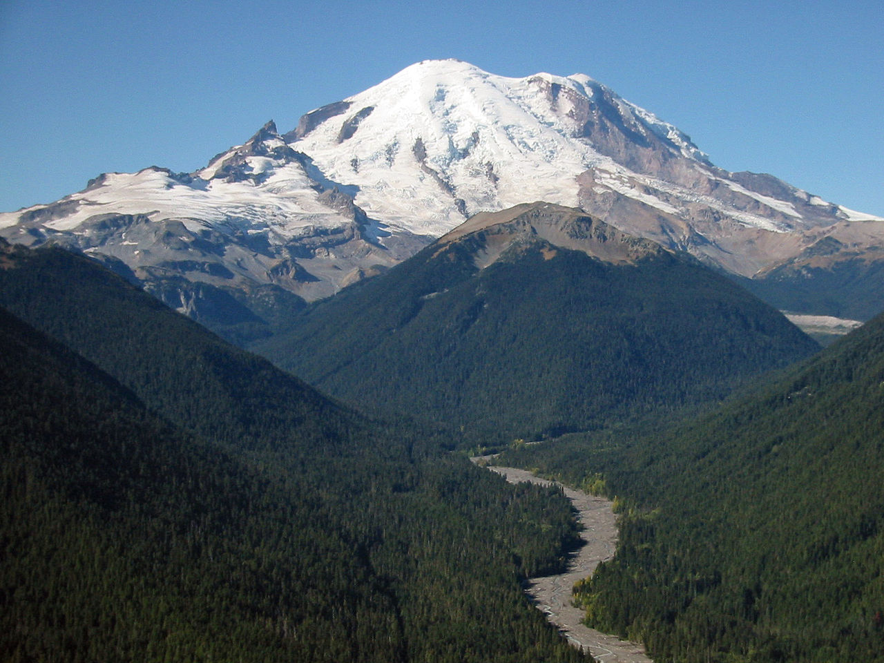
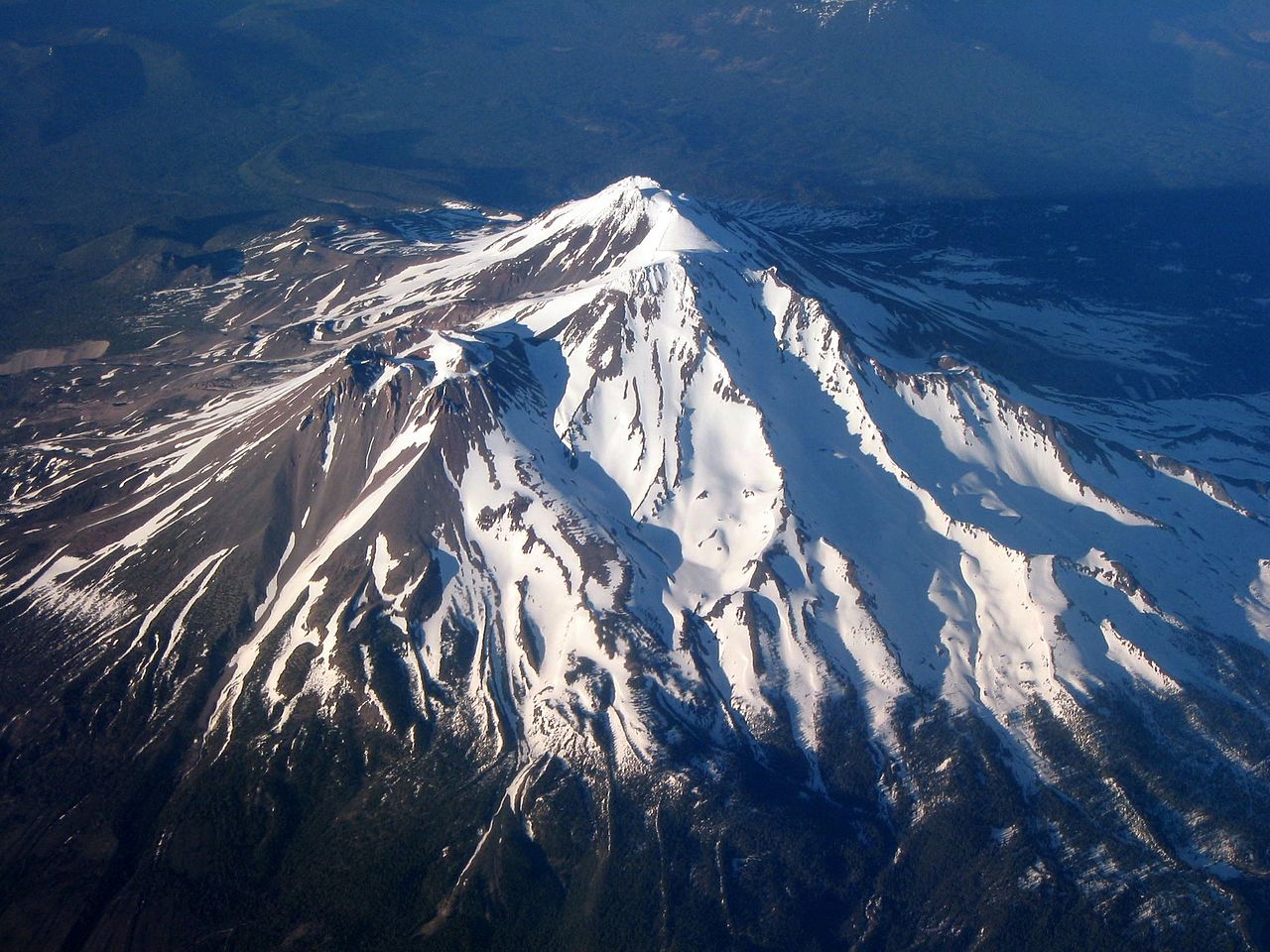
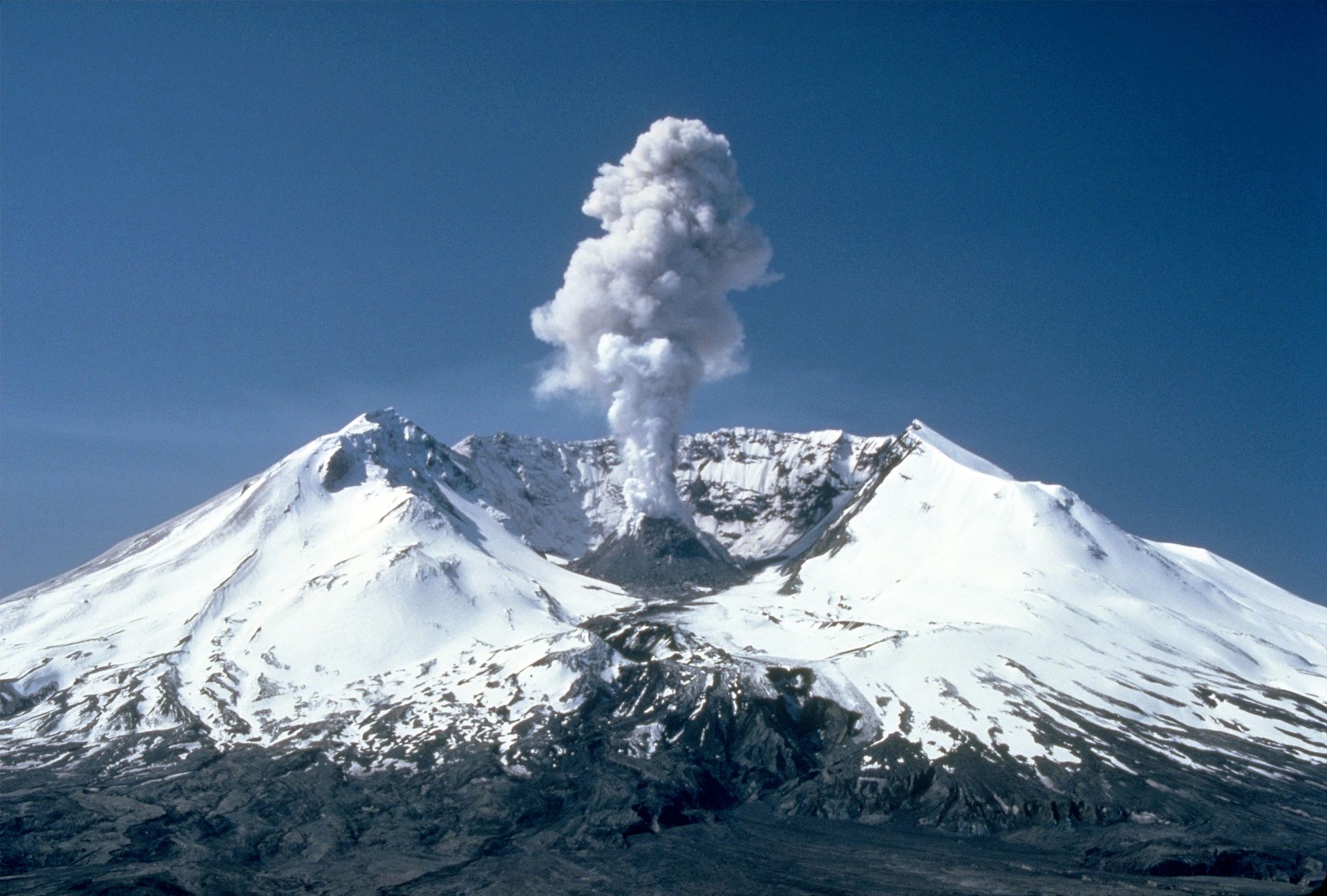
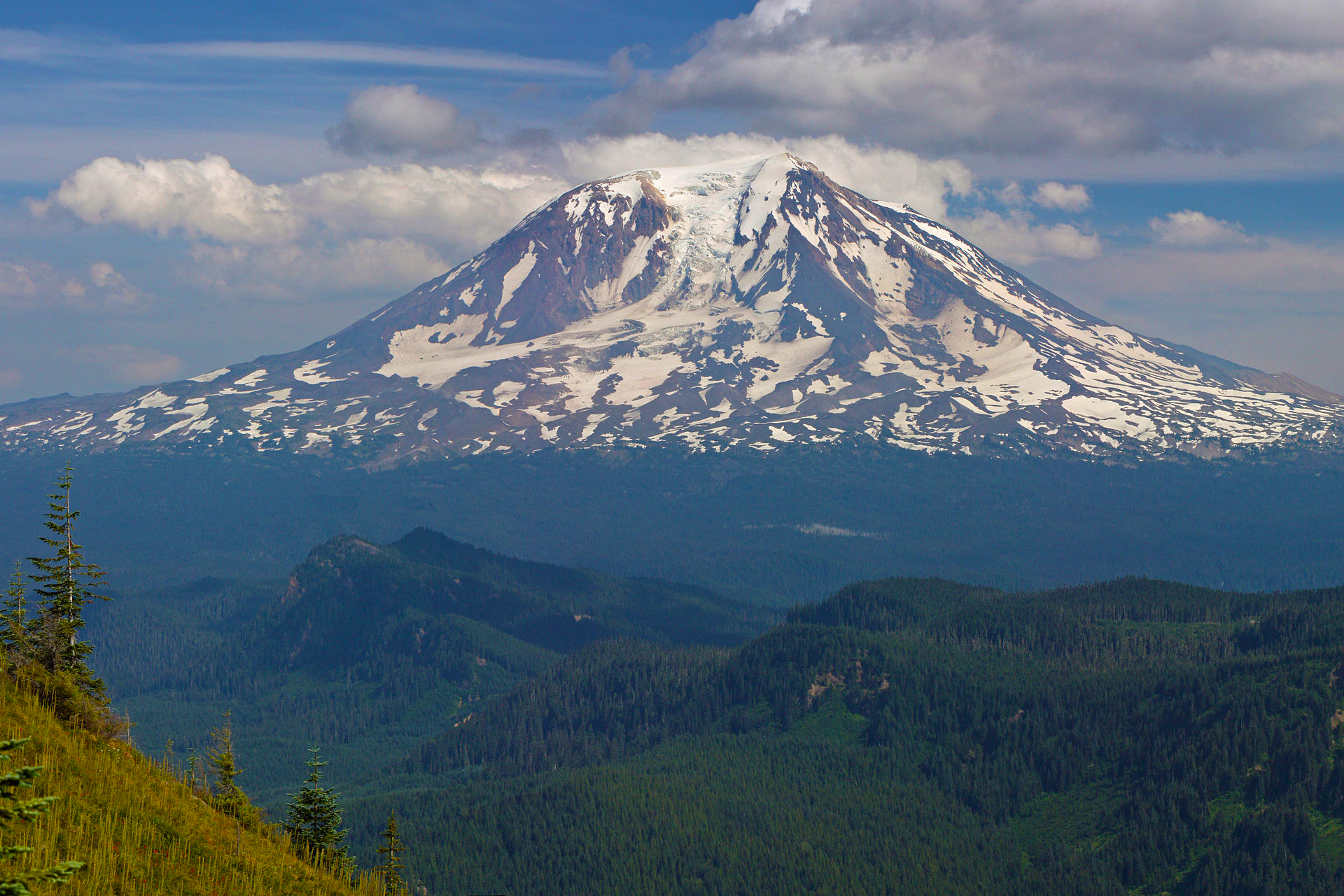
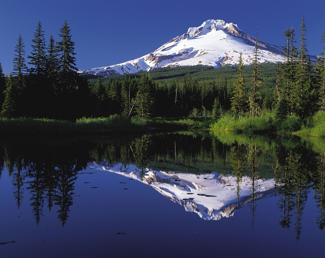
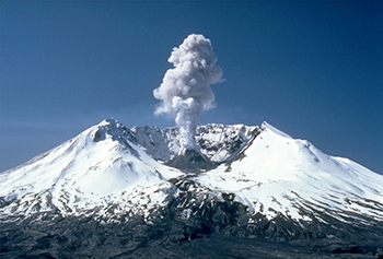
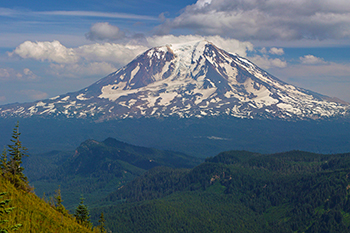
Mt. Shasta, Lassen, Mt Mazama (Crater Lake), Three
Sisters, Bachelor, Jefferson, Washington, Hood,
St. Helens, Adams, Rainer
and Baker are good suppliers of volcanic ash to the Palouse.
For sure 150 Strato
volcanos supplied the ash to develop these soils. Some large and
some were small.
About 17 smaller Strato
volcanoes surround Mt Mazama or Crater Lake
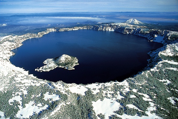
From Wikipedia.
Mount Mazama
is a
complex volcano
in the
Oregon
segment of the
Cascade Volcanic Arc
and the
Cascade Range
located in the
United States.
The
volcano's
collapsed
caldera
holds
Crater Lake,
and the entire
mountain
is located within
Crater Lake National Park.
Its caldera was created by an eruption 42 times greater than the
Mount St. Helens
eruption of 1980.
Mazama�s summit was destroyed by a
volcanic eruption
that occurred around 5677 BC, � 150 years.[1][3]
The eruption reduced Mazama� s approximate 12,000-foot (3,700 m)
height by about 1 mile (1,600 m). Much of the volcano fell into the
volcano's partially emptied neck and
magma chamber.
At 8,159 feet (2,487 m), Hillman Peak is now the highest point on
the rim.
Micro Climates
and North to Northwest patterns were established in wave formations.
A definitive stacked or layered, lift and fall pattern was
established. The result of windblown loess were high value soils.
The weather pattern and the soil development made the land
ideal for winter crops such as winter wheat, winter canola and
perennial crops.
The crop
production story was less desirable for spring crops since there was
very little summer rainfall.
However, irrigation changed lower Columbia Basin.
The critical
part of the equation was the light rainfall pattern with a
moderating lift in the clouds from the Pacific Push 48-hour duration
storms.
The rainstorms were not severe, about 1 inch in
24 hours to about 2 inches in 8 hours. The rain storms of any
significance did not come in the summer time. Snow accumulated
easily on slopes facing to the north.
The rolling
landscape, deep soils developed by grass species with roots to 12 to
15 feet in depth and even deeper. The grasses matured quickly in
permanent cover of the land, e.g. Big Bluestem and Bunch Grass.
In fact, 5,000 to 10,000 years ago, 70% to
95% of the moisture came as snow allowing a slow perk of water into
the grassland soils. Root channels and worm holes were key.
Thus, the water
erosion of the developing soil was minimal due to the long duration
and lighter delivery rainstorms. Snowstorms provided most of the
moisture.
The pattern of
rainfall and type of rainstorm is totally contrary to the rainstorms
of the Great Plains. The mountains and the moderating elevation
changes protected
these soils from eroding cloudbursts.
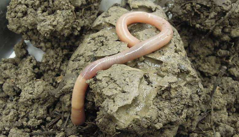
From Wikipedia.
Giant Palouse
Earthworms
https://en.wikipedia.org/wiki/Giant_Palouse_earthworm
roamed and grazed the Palouse soils as a specific evolved
species that harvested the residue and allowed deep penetration of
the melting snow pack.
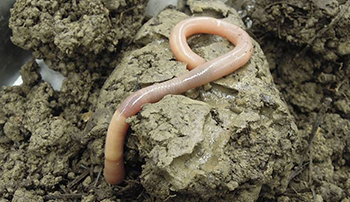
Up to 3.3 feet in length, Burrows to 15 feet and
enjoys surface residue creating worm hole channels for moisture
infiltration.
The Palouse Giant Earthworm had a critical part in developing
Palouse Soils, Right along with Cascade 150 Strato Volcanoes.
The steeper
north slopes were filled with snow during 9 to 10 months slowly
melting into the soil profile. The south facing slopes warmed early
and were snow covered about 6 to 8 months of the year.
With each
explosion of the Cascade Strato volcanoes from Northern California to
Northern Washington a load of ash was deposited across the country
to the Dakotas, Alberta, Nebraska and Kansas.
The deepest
deposits were made close to quick elevation change mountains.
A combination of
wind and a natural bowl of millions of acres allowed the ash to drop
at various specific gravities creating a rolling terrain. The
rainbow effect allowed coarse materials to fall out quicker.
From Wikipedia.
Left to Right: Mount Baker, Mount Rainier, Mt. Shasta, Mount St.
Helens, Mt. Adams and Mount Hood
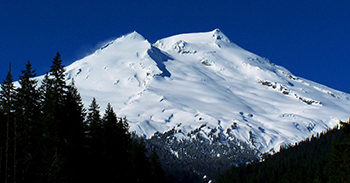
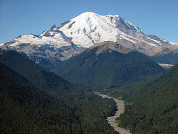


All Cascade
Volcanoes supplied volcanic ash as the standardized direction of air
flow was from the south west to the North to Northeast. Obviously
not always was the airborne flow perfect to the Palouse. The quick
elevation change mountains had a lot to do with drop out of the ash
deposit before lifting over the Rockies.
 Due west 100 miles is
7,000-foot Bitterroot range, 200 miles west, The Montana Continental
Divide, and 250 to 350 miles west the13,000-foot Lemhi and Pioneer
Range and 14,000-foot Teton Range of Idaho and Wyoming. Due west 100 miles is
7,000-foot Bitterroot range, 200 miles west, The Montana Continental
Divide, and 250 to 350 miles west the13,000-foot Lemhi and Pioneer
Range and 14,000-foot Teton Range of Idaho and Wyoming.
The lower
elevations of the Columbia Basin at 300 feet received deep charges
of ash of a coarse nature. Finer ash was deposited at the 2,000
2,500 feet in the big lift over the 5,000-foot Blue Mountains and
the 4,000-foot Palouse Range of the Rocky
Mountains.
As the elevation
increased to 1,000 feet to 2,500 finer and finer ash was deposited
in the Northwestern progression of the �Rainbow Effect�.
A truly
wonderful event in the airborne delivery from each Cascade Volcano.

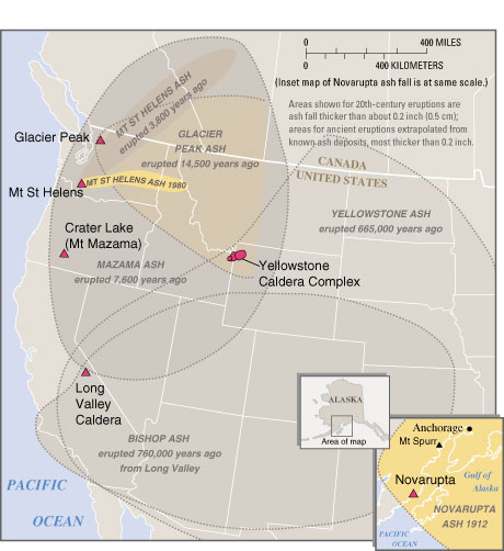
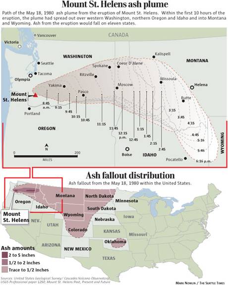
VOLCANIC ASH FALL FROM ANCIENT AND MODERN ERUPTIONS IN THE
WESTERN UNITED STATES
Pacific winds and
Jet Stream can carry small volcanic ash across North America from
150 Strato-Volcanoes of the last 100,000 years.
The Yellowstone
Caldera is also contributor to the stratospheric lifting corridor
several times in the last 600,000 years. The ash can be found 2,000
to 3,000 miles away from the eruption site. Ashland, Nebraska
receives soil from Yellowstone about 1,000 miles away. The smaller
particles move up high in the atmosphere and travel the furtherest.
The size of the
volcanic ash deposit is considerable bigger the closer to the
eruption point. Mt. St.Helens delivered fine ash across the Rocky
Mountains to the Tetons of Wyoming in a 10 hour period. The coarse
ash was deposited about 60 to 100 miles away in the Columbia Basin
at Ephrata and Ritzville, Washington in less than a 2 hour period.
In a recent review of a New Guinea Volcanoes it is was the
discovered that the 1994 double eruption of Vulcan and Tavurvur in
Papua, New Guinea covered the nearby city of Rabaul in a layer of
ash about 2 feet deep, Some areas closer to the volcanoes actually
had deposits of 5 to 7 feet.
Over 100,000 years 150 Strato Volcanoes can easily be regarded as
the soil suppliers and the beginning of the Palouse Country came
from the great Cascade Mountain Range. A North American airlift of
soil creating wealth beyond belief. So the 200 to 500 foot depths of
volcanic ash soil are entirely possible given the aspect of time.
Flora, Fauna, Global Temperatures, The Pacific Ocean and the
Landscape of the Rocky Mountains made the difference. As stated and
for sure the rainfall and or snowfall patterns made a tremendous
contribution.
�The Blues� at Walla Walla.
A precursor range of the Rocky Mountains.
A quick change
in elevation from 300 feet above sea level to 6,400 feet at Oregon
Butte. From the Columbia and Snake River to the top of the Blues
there is a quick elevation change.
In over 40 miles
from the navigable rivers to the mountain tops, a vortex of ash was
deposited with the help of the Blue Mountains on the Horizon.
The Blue
Mountains of Washington and Oregon were critical in the soil
formation of the Palouse along with the Bitterroot Range of Montana
and Idaho. The White Pine Forest of Northern Idaho is creatively
formed with volcanic ash deposits of the Cascade Volcanoes

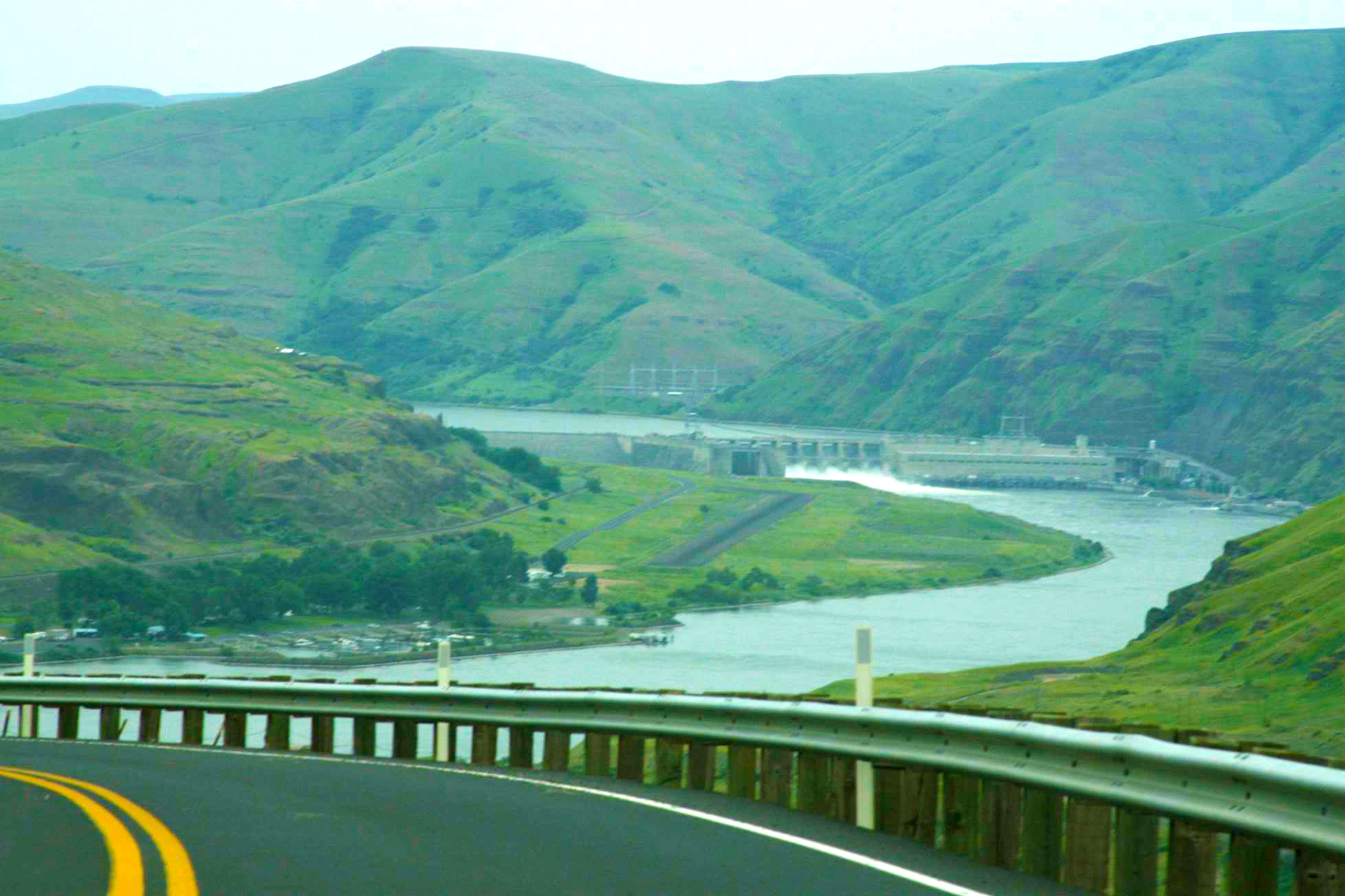
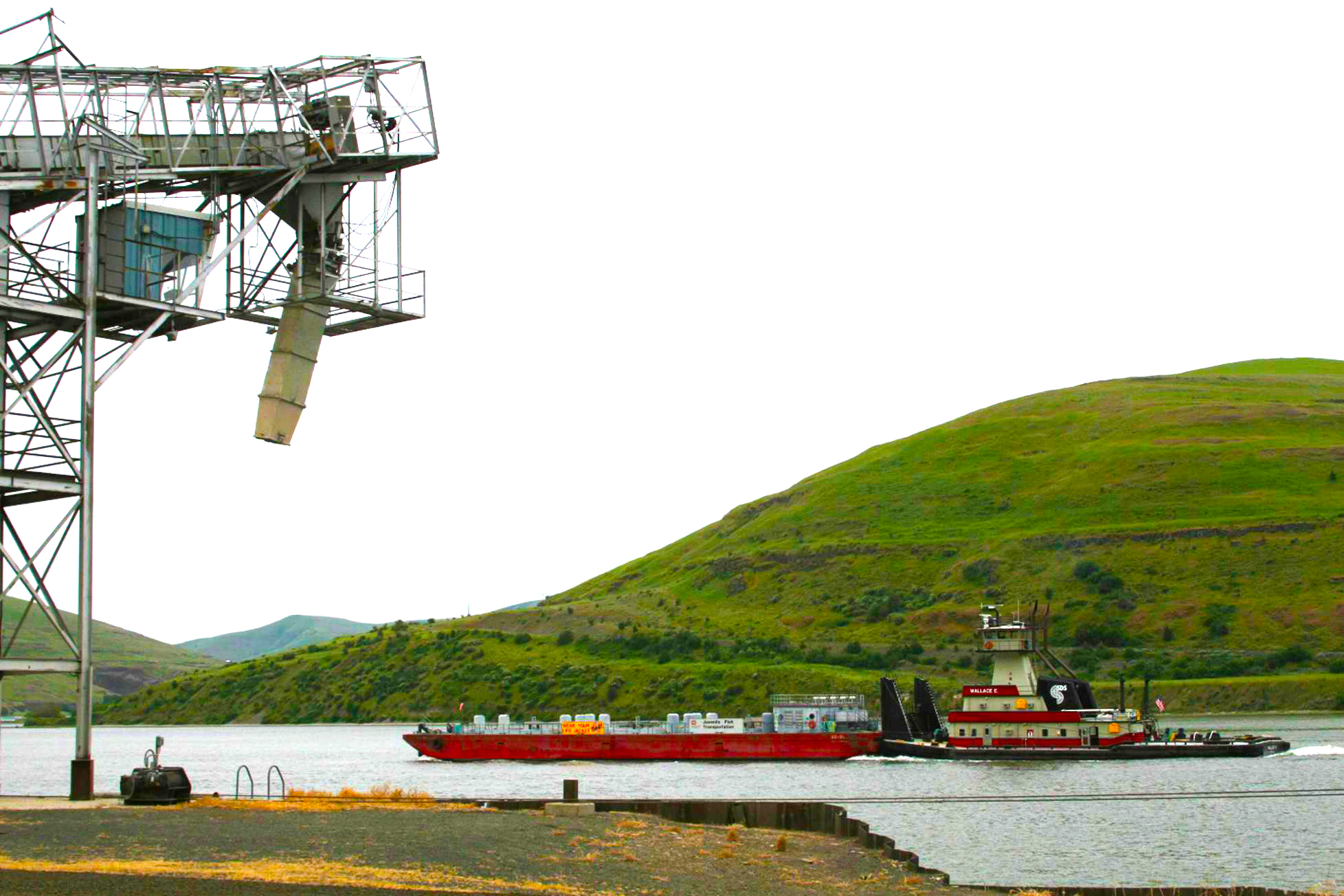
Lower Granite
Dam. Whitman County Washington and in site of the Blue
Mountains.
Juvenile fish
hitch a ride at the Lower Granite Dam in the Little Goose Dam
Pool.
The 5,000-foot
Blue Mountains of Walla Walla provided the transition of
airborne flow of volcanic ash. Deposits were made in the Rainbow
effect of heavy vs lighter ash.
The 2,000-foot
lift created by the Columbia plateau elevation change allowed the
highest volcanic ash deposits to be made very close to the Palouse
and Moscow mountains at 3,500 to 4,800 feet, as well as the Blue
mountains of Walla Walla at 5,000 feet.
Giant lava flows
at depths of 3 miles provide a basalt foundation for the volcanic
ash.
-
Fissures or
cracks in the earth�s mantle are called Dike Fissures.
-
Nick Zenter reports on Flood Basalts.
http://www.nickzentner.com/https/youtube/mxeqetg0xww/
-
Dike Fissures made the lava flows up to 100 miles long and each
layer 200 to 500 feet deep.
-
The Palouse is a lower elevation ash and loess deposit on a 7
million to 15-million-year-old lava rock, basalt plain.
-
A wonderful target for volcanic ash, drifting snow, and grassland
development in a sub alpine climate involving herds of Caribou and
later Elk.
-
The ash of Mt St. Helens became the Palouse country.
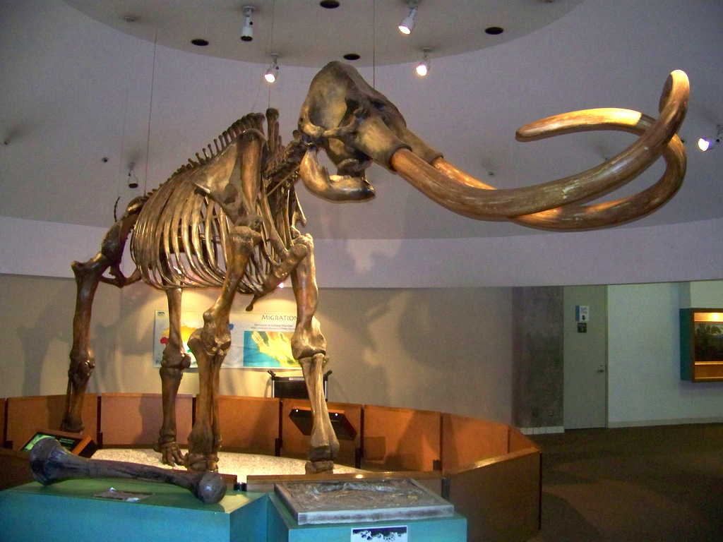
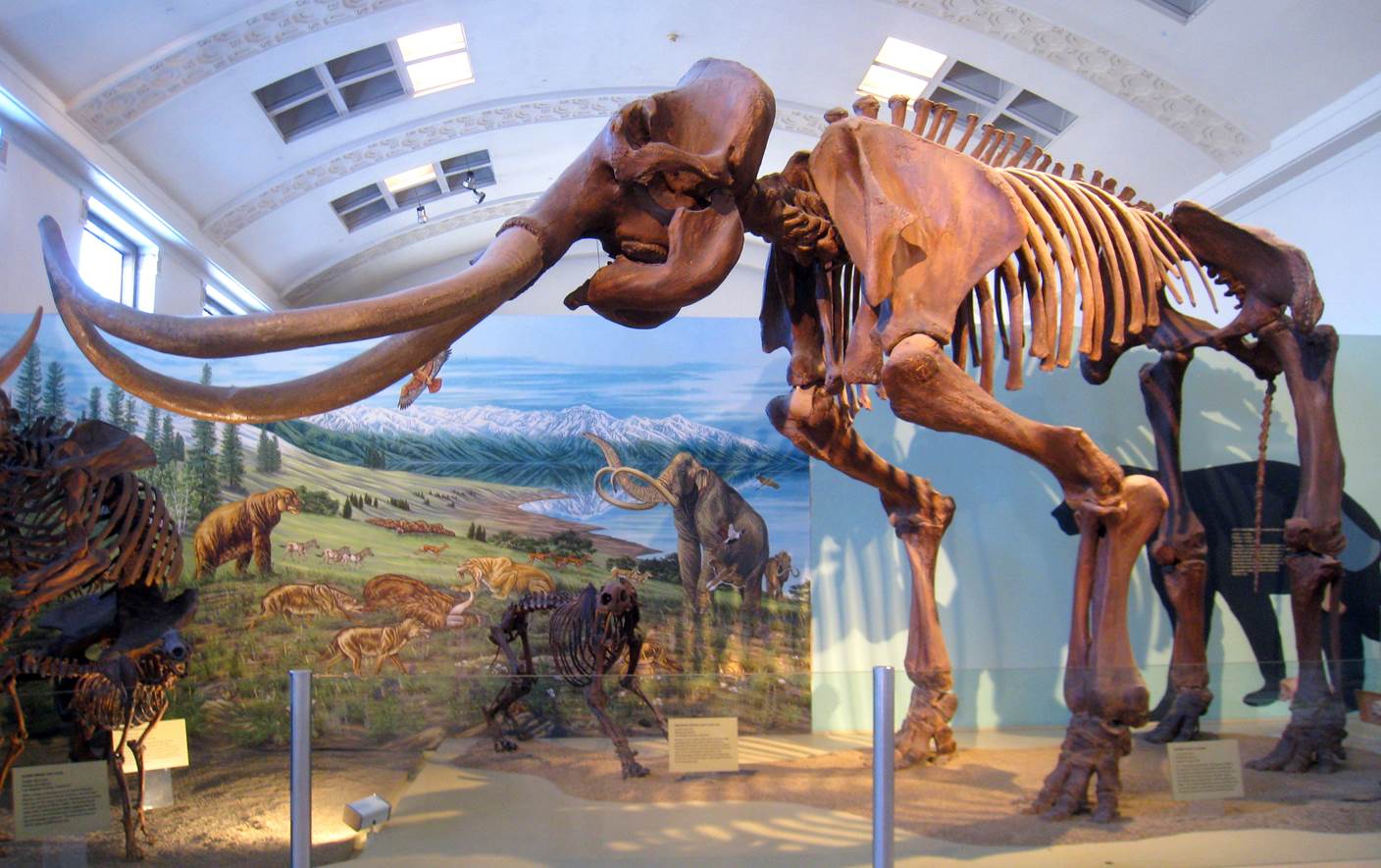
Large Family
Herds of two Mammoth Species Grazed The Palouse Grassland Resource.

Columbian
Mammoth, Tusks 16 feet in length.
Femur Bones as tall as a man.
Weighing 18,000 to 22,000 lbs.
African Elephants
at 13,000 lbs. max. and 10 feet tall are about 60% to 75% the size
of Columbian Mammoths at 13 feet tall.
- African
elephants excrete about 280 lbs. of grass and sedge dung per day
in 2 hour intervals.
- Columbian
Mammoths based on size would return to the land 466 lbs. per day
of grass and sedge dung per day.
- If food
supply is plentiful African elephants will eat 992 lbs. of grass
and sedge per day.
- Based on
this observation of African Elephants with a good food supply the
Columbian mammoth could eat up 1 ton per day and excrete1,600 to
1,700 lbs. per day of dung.
- So a good
food supply of healthy grass and sedge may have started to
disappear (desertification) at the end of the last Ice Age or
about 16,000 to 10,000 years ago.
- One of the
last great holdouts for good grass and sedge was most likely the
Palouse and just before the Great Missoula Floods of 10,000 years
ago.

The largest
mammal ever on the planet grazed the Palouse with other Ice Age
mammals, Saber Tooth Tiger, Dire Wolfs, Reindeer, Musk Ox, Horse and
Short Faced Bears
The Columbian
Mammoth was much bigger than the Woolly Mammoth
probably due to a more extensive and open food supply for the
Columbian Mammoth.
- The Woolly
Mammoth was small and dealt with more harsh survival conditions of
advancing and receding glaciers in the Interlaken geography of the
Ice Age.
- Several
fossil finds of the Columbian Mammoth were made in
the 1876 period in bogs and springs of Latah and Rosalia, WA.
The prime
overland herbivore was able to feast on tall grasses
such as big bluestem and bunch grass eating constantly up to 400 to
500 lbs. per day.
The Columbian
Mammoth began to close its history on the Palouse and Columbia Basin
about the time of The Great Missoula Floods.
The mammoth
began to phase out about 13.000 to 10,000 years ago due to
climate change such as natural grass and forest burning reducing the
food supply.
Hunting of
Columbia Mammoths is considered a major factor in the decline of the
very large mammal with a long gestation period.
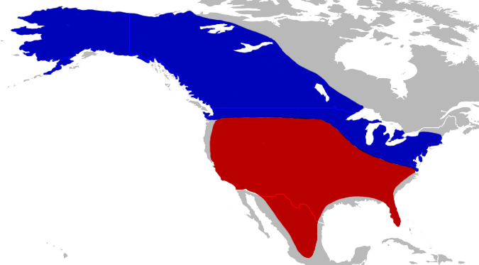
The overlapping
range of two species of mammoth over several Ice Ages based on
fossil findings.
- In
Washington State, The Columbia Basin and The Palouse are locations
inhabited by the Woolly Mammoth(Blue)and the Columbian Mammoth(Red).
- A viable
range for the world�s largest mammal for 1.5 million years.
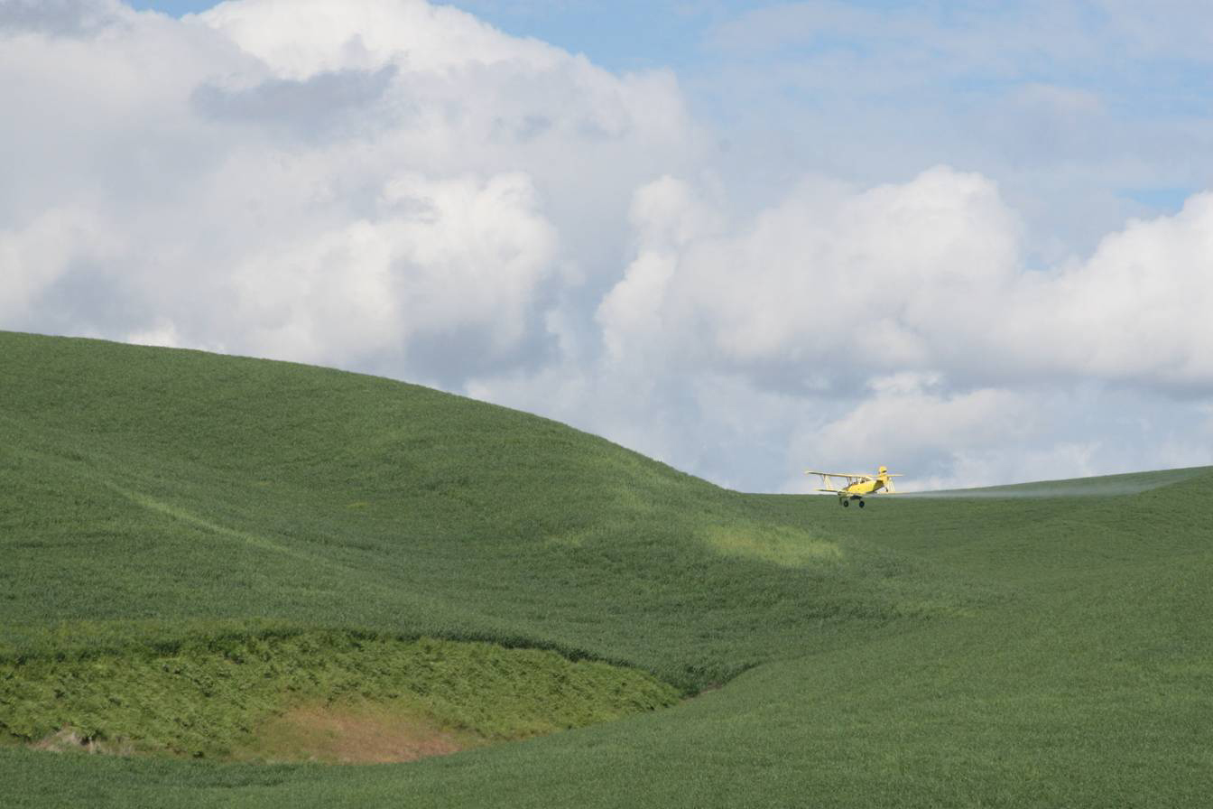
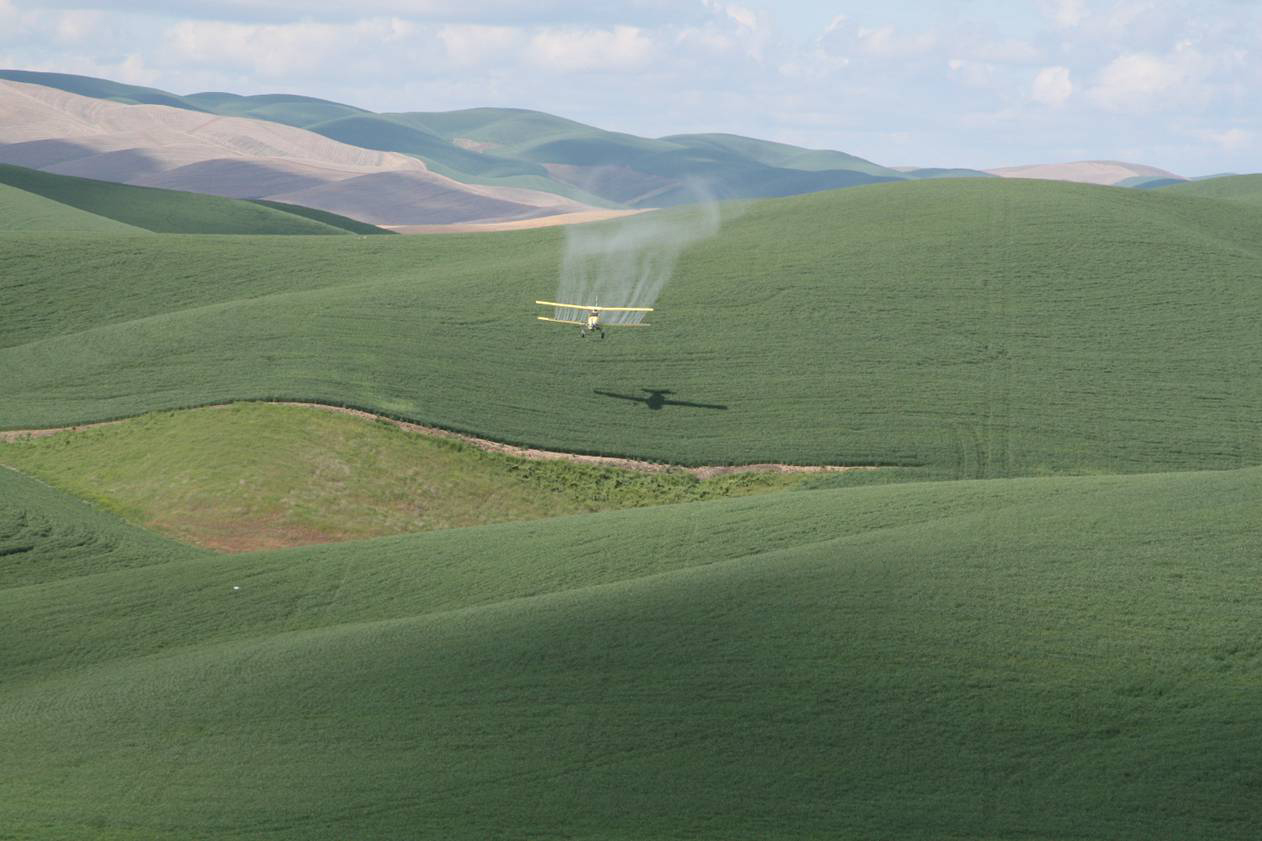
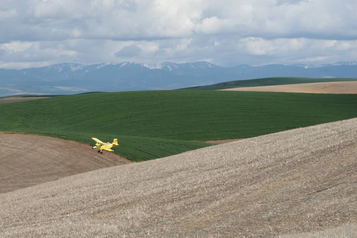
Coming in for a landing, and a quick
take off.
-
The light
spot in field was too steep to farm thus the term �eyebrow�. The
eyebrow was pushed in leaving a volcanic ash deposit.
-
Adjusting
or eliminating the eyebrow�s position on the slope improves the
farming efficiency.
-
Most of the
eyebrows are at the Angle of Repose and just not worth the risk of a
realignment or the dozer push in technique.
Make a
lot of money with no life insurance.
http://www.exactrix.com/Broadcast_05_03_2016.htm

Truth
or Consequences. For every action there is an opposite but equal
reaction.
The results of tillage are shown in the mud flow of soil into the
Snake River.
-
The
Palouse River in March is the most polluted in the nation.
-
Flood Stage at the mouth of the Palouse River delivers a mud flow of
Palouse soils to the Snake River in a 190 foot drop.
-
No high quality game fish swim in this river due to the cataract
drop and the pollution of farmer introductions of the pollutants.
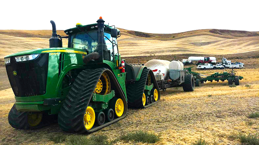
No-tillage is
the solution. Gravity is working against every Palouse farmer.
http://www.exactrix.com/Broadcast_09_25_2017.htm
,
Tango
Foxtrot, Red Green. Stopping the Tillage.
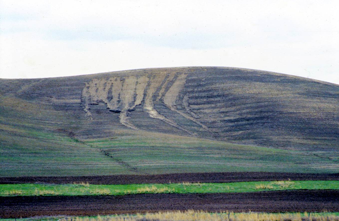
Erosion created
by tillage, rotation and a bad manager.
-
Erosion is not a common event in No-tillage farming.
-
In
fact, just the opposite with soils improving with single pass two
pass crop rotations using single disc openers and stopping
tillage.
-
Gravity on steep slopes simply takes over when the roots are
broken the soil moves downhill.
-
Tillage takes away the root channels and worm holes and assures that
rainfall cannot penetrate the soil to deeper depths.
-
Rainfall must go into the soil where it falls. Runoff is lost yield
and soil lost.
-
About 20 to 25 inches of moisture can be stored in
the root zone of high quality winter canola and winter wheat.
Placing bets on a good crop requires tillage to be eliminated.
No-tillage Farming changed the Palouse. Yielder Drills and
"Old
Yeller" forever changed the chances.
More about the history of No-tillage in PNW and Ohio.
http://www.exactrix.com/Broadcast_02_27_2018.html

Advancements
into 2018 show improved soil structure and a good chance for the
next generation
Giant
No-tillage Crops for 35 years prove that there is no other way.
http://www.exactrix.com/Broadcast_10_13_2017.htm
In 1974,
No-tillage starts in sight of Steptoe Butte. �Old Yeller� and Mort
Swanson on the Palouse.
100,000 years
to build.
100 years to destroy.
-
And a chance to begin rebuilding the soil in a land-owner�s
lifetime. This is a very big deal.
-
Stopping the tillage is critical and moving away from Winter Wheat.
-
In certain areas, 90% of the erosion comes from the Winter Wheat
Rotation.
Changing the
rotation to more functional and economic crops like Winter Canola is
critical.
http://www.exactrix.com/Broadcast_08_25_2017_Canola.html
Learn
More about Winter Canola and how it is raised to stop erosion in the
PNW.
Fall 2016, The Palouse has a last
chance with advanced producers.
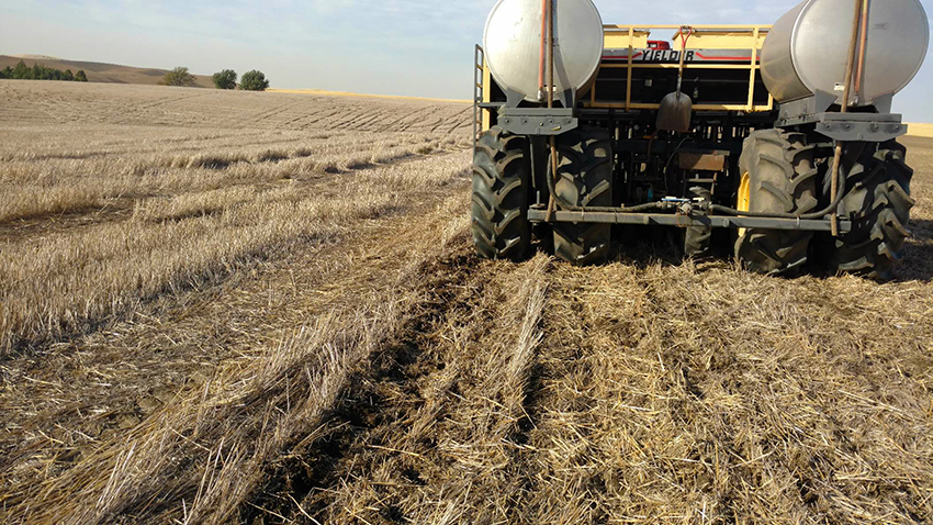
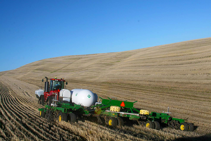
At
St. John Washington, Century Farms, Ross Jordan expands in 2 pass
No-tillage crop production fall banding Exactrix TAPPS for spring
wheat.
The Palouse Problem, has it been
fully explained?
Not all is understood yet.
The next chapter with 100,000 more years of man-made soil management,
the dynamic Palouse will look a lot different.
http://www.exactrix.com/Broadcast_10_24_2016.htm
Less Erosive Winter Wheat Because It is a Costly Crop.
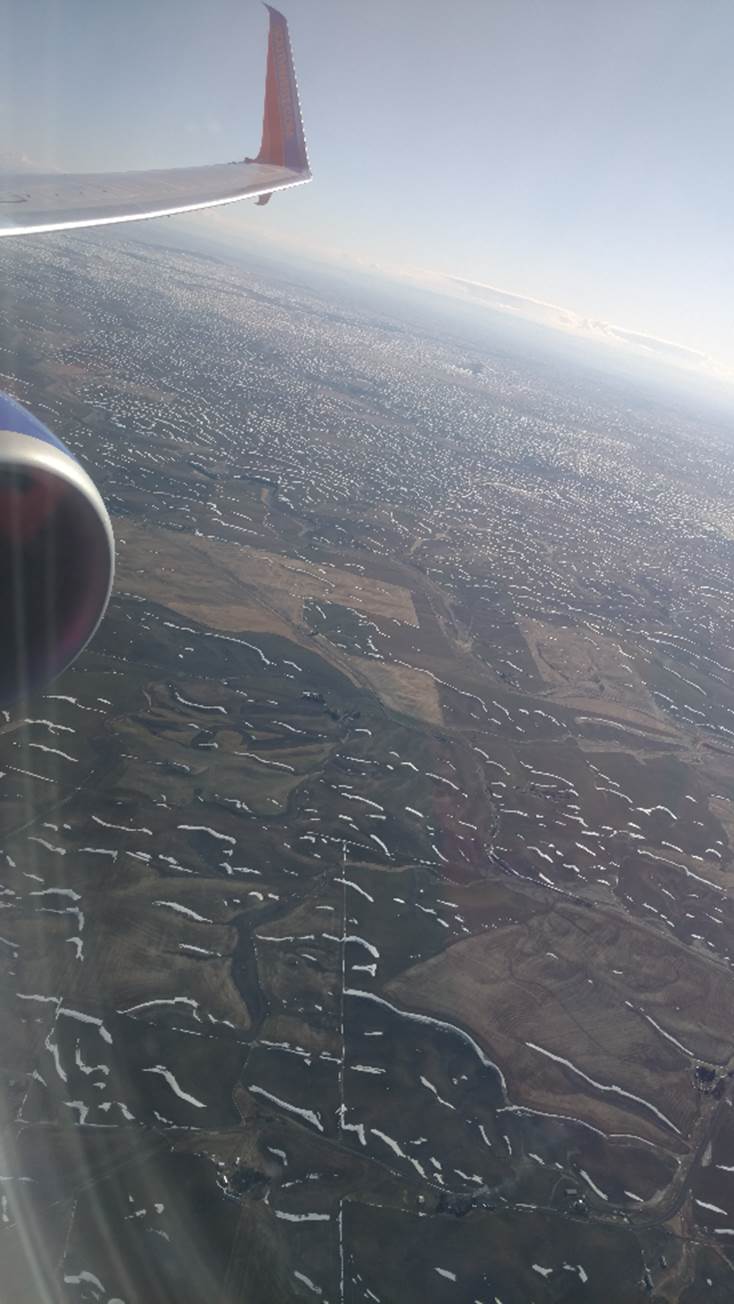
March 11, 2018. Returning to Spokane from Denver. Southwest Flight
about 3:25 pm.

After 70 plus years of shank tillage application,
NH3 is finally a true No-tillage material at depths to 7.5 inches
at speeds to 12.5 mph.
The Exactrix 1% CV injection process makes TAPPS 166% more crop
available.
Stay in the game with crystalline Exactrix TAPPS and build soil test
P.
www.exactrix.com/mustang.htm.
The payback is Mustang fast.
Nominal returns in wheat, corn, cotton and Milo at $30 to $100 more
net income per acre or 12% more net margin.
Note: STEEP University test plots and producer tests confirm
improved returns year after year.
Less is More
|


 See Video